Independent forest valuation and crop assessment.
Independent valuations, growth forecasts and windblow risk analysis for sales, lending and investment decisions — professionally indemnified, from foresters who measure the crop themselves and neither buy timber nor harvest it.
Measured, forecast and valued by the same people.
Every valuation starts with the crop as it stands: measured in the field and, where the property is large or hard to walk, flown first.
Forest appraisal and valuation
Standing timber and forest property valued for a sale or purchase, lending or an investment decision — on measured volumes, not assumptions.
Timber volume assessment and forecasting
Current volume by assortment, yield class and growth forecasts for a stand or a portfolio, with the thinning and felling programme that follows.
Windthrow hazard assessment
Exposure, soil, height and stability assessed so thinning and felling decisions account for the risk of windblow.
Sub-optimal crop and establishment surveys
Crops that are failing, thinly stocked or poorly established surveyed and reported, with the options for each area.
Storm, fire and windblow assessment
The affected area mapped from drone imagery, measured and reported by subcompartment, with the volumes and the salvage, replanting and licensing options.
Disease assessment
Phytophthora surveys from multispectral imagery and field inspection — the crop classified healthy, not healthy or dead, tree by tree where it matters — and ash dieback assessed on the ground.
What happened, how much, and what now.
After a storm, a fire or an outbreak, an owner needs three numbers quickly: the area affected, the volume in it and the options for each part. Drone imagery gives the first two across the whole property; the field inspection confirms them and sets out the third.
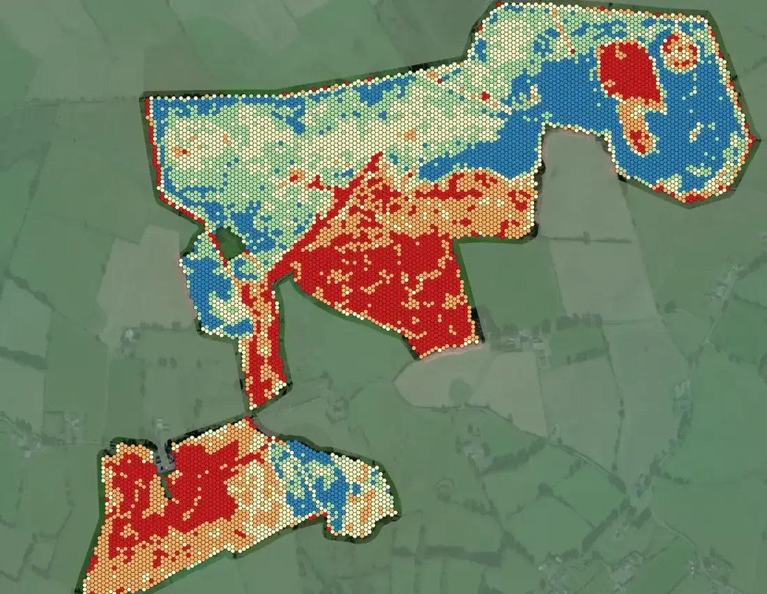
- Fire damage mapped from multispectral drone imagery and reported area by area — 94 ha assessed and 57 ha burnt on one property in August 2026, with a neighbouring property flown the same day
- Windblow property surveys: the blown area mapped and measured, with aerial photographs of each property
- Phytophthora in larch across nine properties in summer 2026: three map sheets and a results table for each, the crop classified healthy, not healthy or dead
- A dying estuary-side crop traced to likely tidal flooding, with a breach simulated and a weak section of embankment pinpointed from the LiDAR elevation model
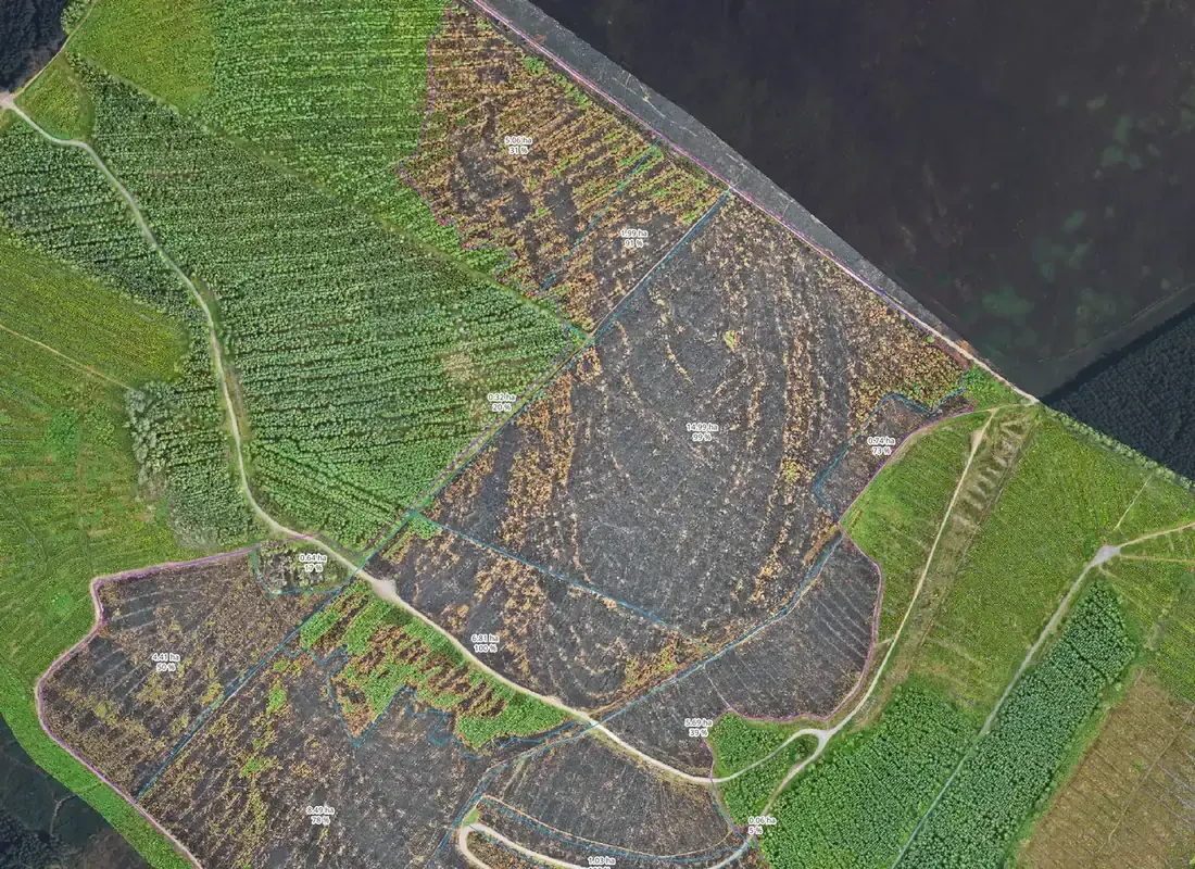 Fire damage by subcompartment
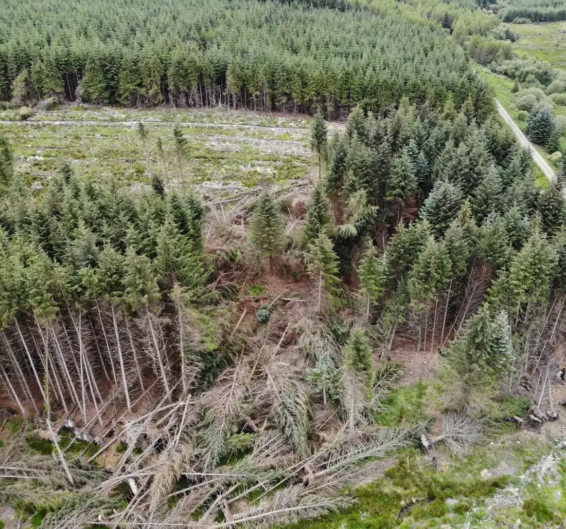 Windblow from the air
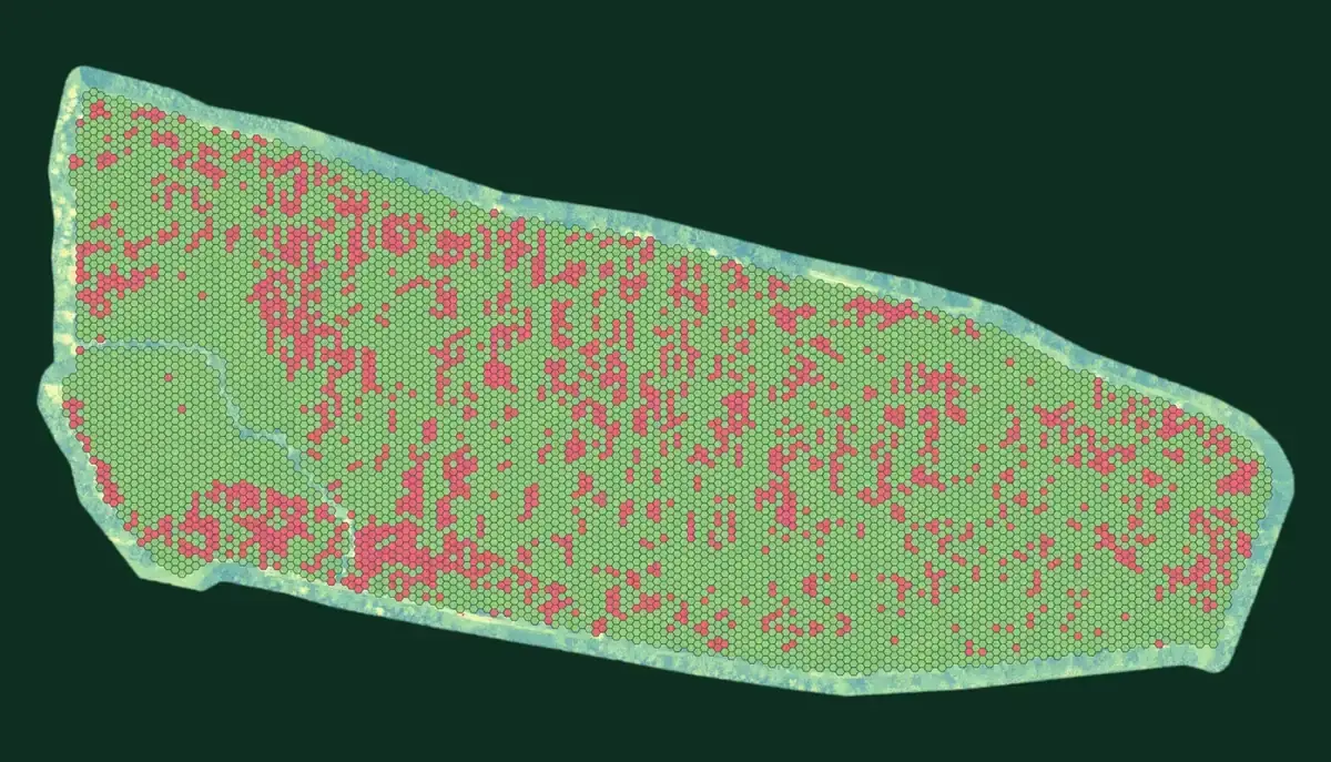 Larch tree-health assessment
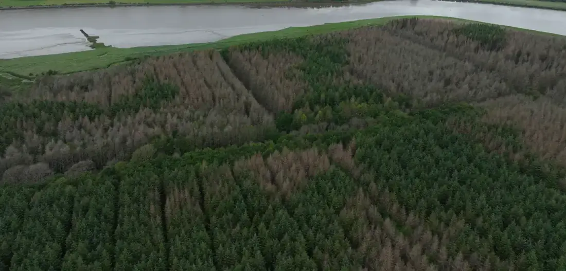 Dieback beside an estuary
Before you pick up the phone.
Are you independent of timber buyers?
Yes. FMI neither buys timber nor harvests it, and we carry professional indemnity insurance. A valuation or a pre-sale measurement from us is prepared for whoever commissions it — an owner, a purchaser, a lender or an investor — and is independent of any timber buyer.
What does a valuation need from me?
Where the forest is, any maps, planting records, grant or licence paperwork and previous inventories you hold, and what the valuation is for — a sale, a purchase, lending or an investment decision. We measure what is standing, forecast its growth and value it on that basis.
Can you assess storm, fire or disease damage?
Yes, on the ground and from the air. Windblow, fire damage and disease are mapped and measured from drone imagery and checked in the field — the blown or burnt area by subcompartment, the crop classified healthy, not healthy or dead — with the volumes and the options that follow.
Need a number you can stand over?
Tell us about the forest and what the valuation is for. A forester replies within one working day. The first call is free.