Independent forestry consultants — on the ground and from the air.
Forest management, inventory, drone LiDAR and topographical survey for energy companies, semi-state bodies, investment funds and forest owners — in every county in Ireland.
Wind, solar & energy projects
Felling licences and exemptions, survey-grade LiDAR topographic survey, restock assessment and habitat plans — at every stage of a project.
Own a forest or farm woodland?
Straight advice on thinning, felling, replanting, licences and sales — from foresters who measure the crop themselves.
Funds, utilities & public bodies
Portfolio management, inventory, valuation and survey data at scale, to your own standards and systems.
Six services, one team of foresters.
From a single stand to an entire portfolio, the same people plan the work, measure the crop and stand over the numbers.
Forest management
Full management of estates and investment woodlands: planning, operations, licences, compliance and reporting you can rely on.
About this serviceContinuous cover forestry & biodiversity
Moving single-age conifer plantations towards permanent, mixed, multi-aged forest that keeps producing timber — every stem marked, every departure recorded, permanent plots remeasured on a three-year cycle.
About this serviceInventory & timber measurement
Pre-sale measurement, inventory, thinning control, establishment and windblow surveys, boundary marking and inspection path cutting — from Ireland’s largest independent provider.
About this serviceAerial LiDAR & multispectral surveys
Our own drones, LiDAR and multispectral sensors: canopy height, stocking, tree health, terrain and flood risk, surveyed with centimetre-level positioning.
About this serviceFelling licences & consents
Felling licence applications and exemptions, replanting obligations, disease surveys, and the forestry inputs that wind farm, solar and grid projects need.
About this serviceValuation & crop assessment
Independent valuations, growth forecasts and windblow risk analysis for sales, lending and investment decisions — professionally indemnified.
About this serviceWe fly and process our own LiDAR.
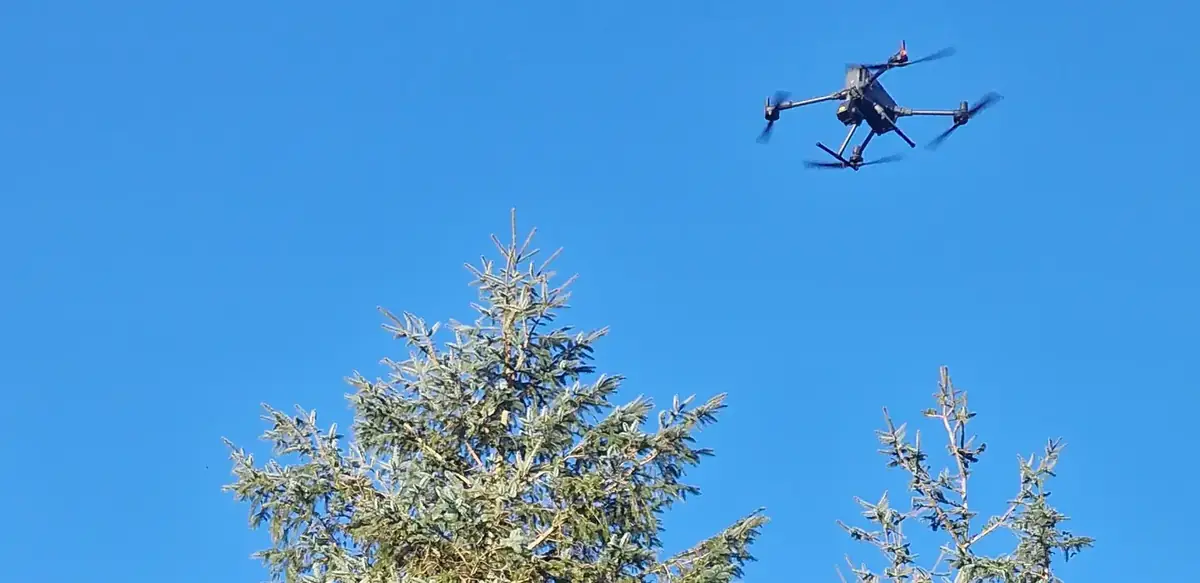
FMI is a registered drone operator with its own aircraft — LiDAR, 45 MP photographic and multispectral sensors, RTK-positioned, ground-controlled and checked against independent checkpoints. The data is processed in-house and interpreted by foresters who then walk the crop.
- Tree heights, stocking grids and canopy gaps for every subcompartment
- Tree health classified tree by tree, and productivity mapped, from multispectral imagery
- Terrain, drainage and flood simulation from the same survey
- Survey-grade terrain models, contours and survey control for site design — in ITM and Malin Head datum
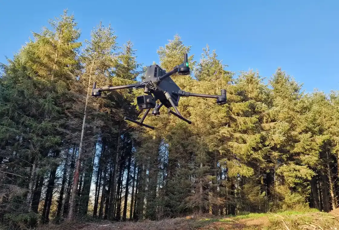 FMI’s survey drone with the Zenmuse L2 LiDAR sensor
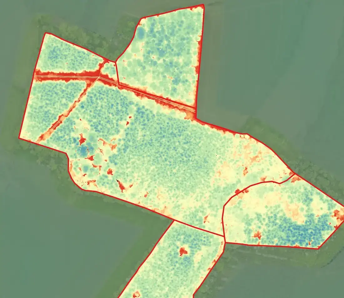 Canopy height model · Ballyhale, Co. Kilkenny
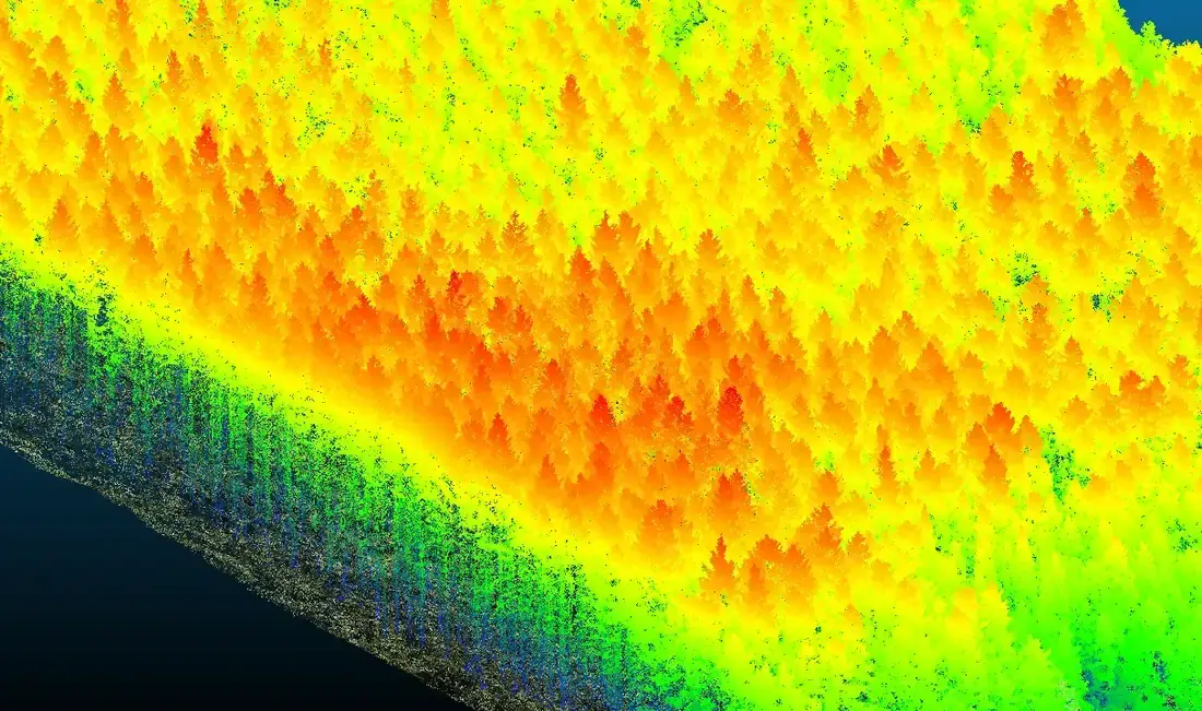 Ground and canopy separated in the point cloud
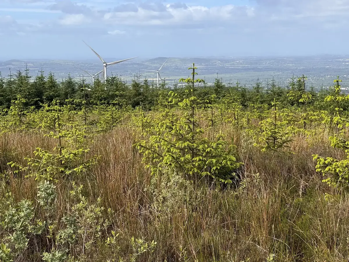 Replanted ground on an operating wind farm · restock assessment, 2026
The forestry side of energy projects, handled.
Wind and solar projects are often built on forested land, and that brings licences, replanting obligations and habitat commitments with it. FMI works for wind farm and solar companies across Ireland at every stage — before consent, during construction and in operation.
- Felling licences, exemptions and replanting obligations
- Restock and reinstatement assessment after construction
- Habitat plans, keyhole felling and vegetation management near lines and turbines
Six jobs, six very different questions.
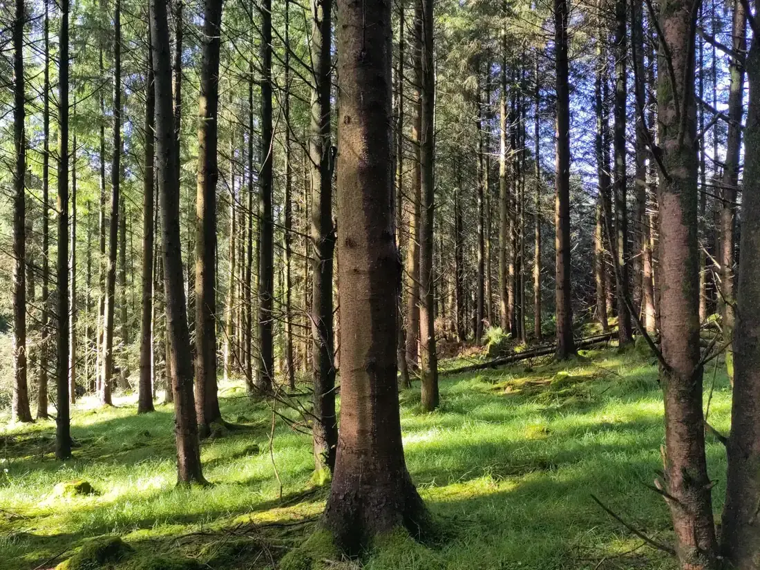
A 1960s conifer estate: from clearfell rotations to continuous cover
Forest manager for a utility’s 640 ha lakeside estate, 418 ha of it forest, around a public drinking-water reservoir: 26.8 ha thinned under continuous cover in 2025, every stem marked and every load reconciled, 590 naturally regenerating native saplings sheltered and GPS-recorded in 2026 — shown to the EU Nature Directors in September 2026.
More about this work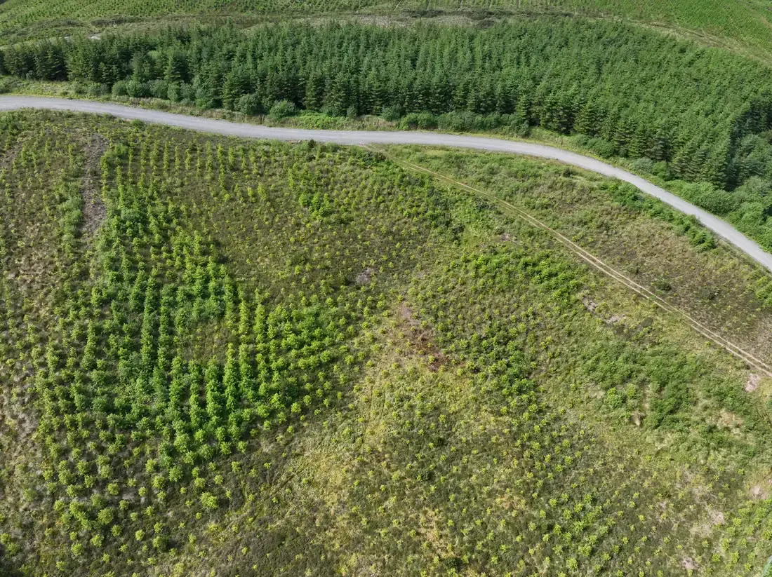
An operating wind farm: why isn’t the replanting taking after reinstatement?
Multispectral drone survey, field inspection and soil investigation of the areas replanted after infrastructure works — 4.02 ha needing intervention, with an action for every subcompartment.
Read the case study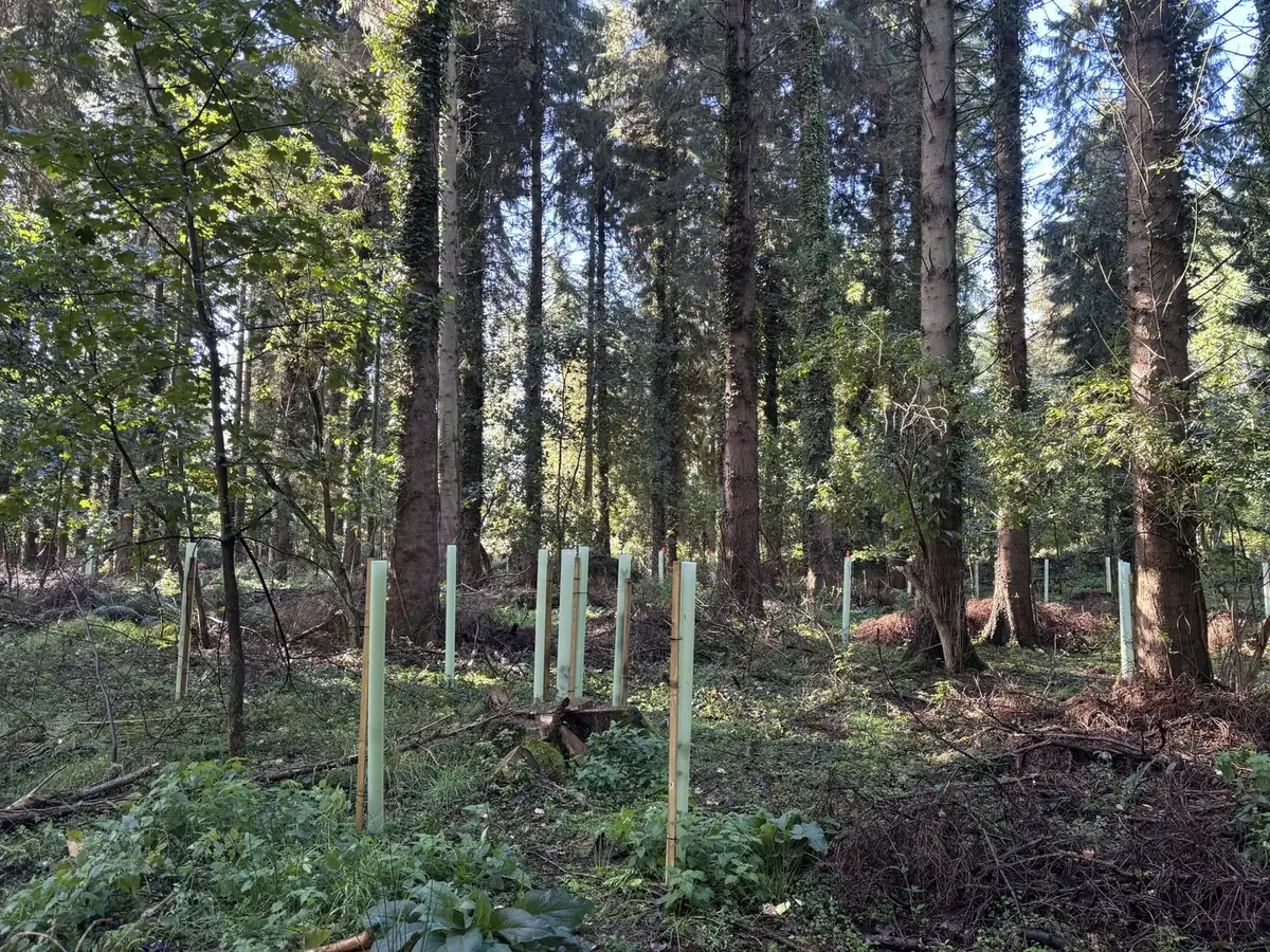
Protection instead of fencing: 590 native saplings, each one a point in the GIS
Deer browsing is the one constraint on the regeneration that continuous cover depends on. At the owner’s direction, FMI’s crews found the native saplings released by the thinning — three in four of them oak — and protected each one by hand with a shelter and stake: no fencing, no machinery, no ground disturbance, every stem GPS-recorded so its survival can be measured rather than assumed.
More about this work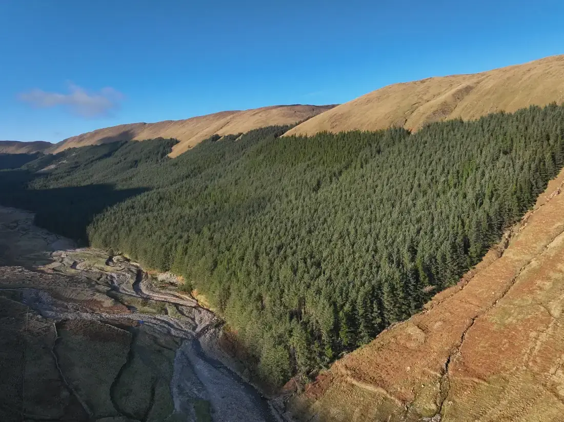
Nearly 300 ha of mature spruce on a mountainside with no forest road
A LiDAR survey of 1.19 billion points — over 400 per square metre, more than 270 of them classified ground points beneath the canopy — followed by ground plots: revised subcompartments, yield classes and a volume breakdown by sawlog, pallet and pulp for the owner.
Read the case study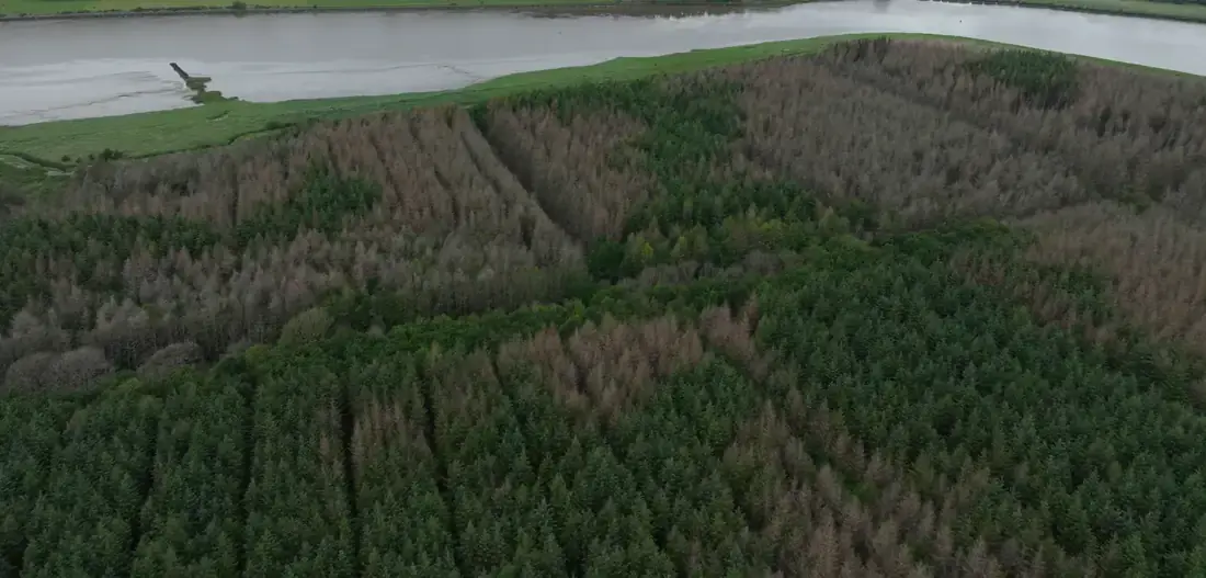
Why is the crop dying, and where is the water getting in?
LiDAR, 45 MP photography and multispectral imagery combined to trace tree mortality to likely tidal flooding, simulate a breach and pinpoint a weak section of embankment.
Read the case study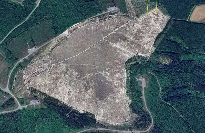
A plan to bring the hen harrier back to a nest site near a turbine
A habitat enhancement plan with survey, inventory, timber volumes, operational scenarios and the felling-licence route — proposing to restore former nesting areas and clear regeneration from the edges of 46 ha of upland heath.
Read the case studyContinuous cover forestry and biodiversity monitoring, recognised twice in 2026.
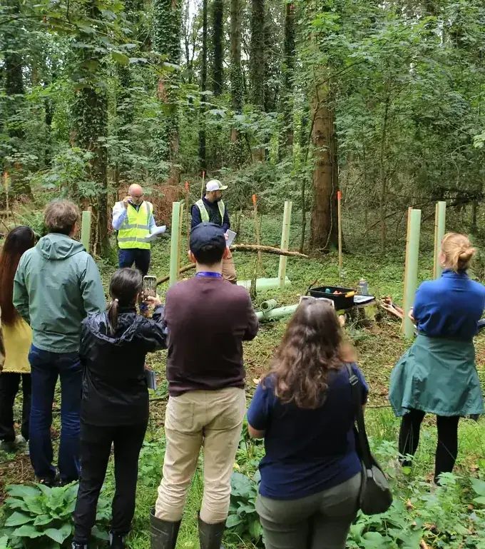 Presenting to the EU Nature Directors · 15 September 2026
Showing Europe’s nature directors what continuous cover looks like on the ground.
During Ireland’s Presidency of the EU, the Nature Directors of the member states visited a utility-owned estate under FMI management. FMI’s foresters presented the transition from clearfell rotations to continuous cover forestry and the network of permanent biodiversity plots that tracks it, and led a planting demonstration of the next crop establishing under the canopy — young oak and other native trees, planted or naturally regenerating, sheltered from deer.
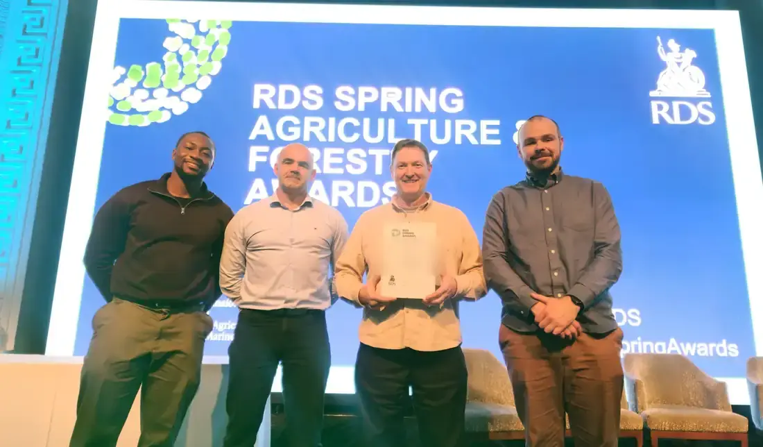 RDS Concert Hall, Dublin · April 2026
Finalist — Silvicultural Excellence & Innovation.
An estate under FMI management was shortlisted at the RDS Spring Agriculture & Forestry Awards for its planned, evidence-led transition from clearfell rotations to continuous cover forestry — the first areas converted in 2025, backed by a network of permanent biodiversity plots and habitat mapping across the estate.
An independent company, run by foresters.
Danny Quinn has provided forest measurement services since graduating in forestry in 2001; Forest Measurement Ireland Ltd was registered in January 2012 and has grown from them. Today FMI is Ireland’s largest independent provider of forest inventory and timber measurement, and manages, values and surveys woodland for semi-state companies, investment fund managers, energy companies, private forest owners and farmers.
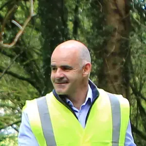
A team of nine. Our foresters — every one holding a degree in forestry — are based in Sligo, Cavan, Kildare, Wicklow, Wexford, Kilkenny, Waterford and Tipperary and work in every county. Aerial operations are led by three IAA-registered pilots, with mission planning and aviation safety overseen by a serving airline captain and UAS instructor and examiner who has supervised our operations manual since 2021; data management and processing by a senior forester with 13 years in GIS and remote sensing; and health and safety by a director with 20 years’ HSE management experience.
- Registered Foresters with the Department of Agriculture, Food and the Marine (DAFM); members of the Society of Irish Foresters and ProSilva Ireland
- Registered drone operator with the Irish Aviation Authority (Operator ID IAA-2021-28153), with three IAA-registered pilots and an operations manual overseen by a commercial pilot since 2021
- Insurance in place: aviation liability, professional indemnity, public liability and employer’s liability — certificates on request
- Safety Statement under the Safety, Health and Welfare at Work Act 2005; quarterly risk assessments and site audits; crews Safe Pass, first-aid, manual-handling and environmental-risk trained
- Management systems run to ISO 9001, 14001 and 45001 principles (not certified); two-person sign-off on every dataset; 100% on-time delivery on our national measurement contracts since 2017
- Greenhouse-gas inventory to a method aligned with ISO 14064-1: 92.7 tCO₂e for March 2025–March 2026, 2.87 kg CO₂e per hectare surveyed
- Data protection: GDPR-compliant handling of enquiries and survey imagery, held on access-controlled systems in Ireland — see our privacy notice
- An Irish SME whose foresters live and work in eight counties; drone hardware part-funded by Kilkenny County Council
Tell us about your woodland or your site.
A forester replies within one working day. The first call is free. Give us the basics and we will come back with what is needed and a written estimate.